 CULTURETECHLENS
Africa in 1657 — Blaeu & Visscher, Nova totius Africae tabula
Willem Janszoon Blaeu’s Africa plate as issued by Nicolaes Visscher, Amsterdam, 1657 — the continent as the Dutch Golden Age mapped it: hand colored, 92 × 134 cm in the original sheet.
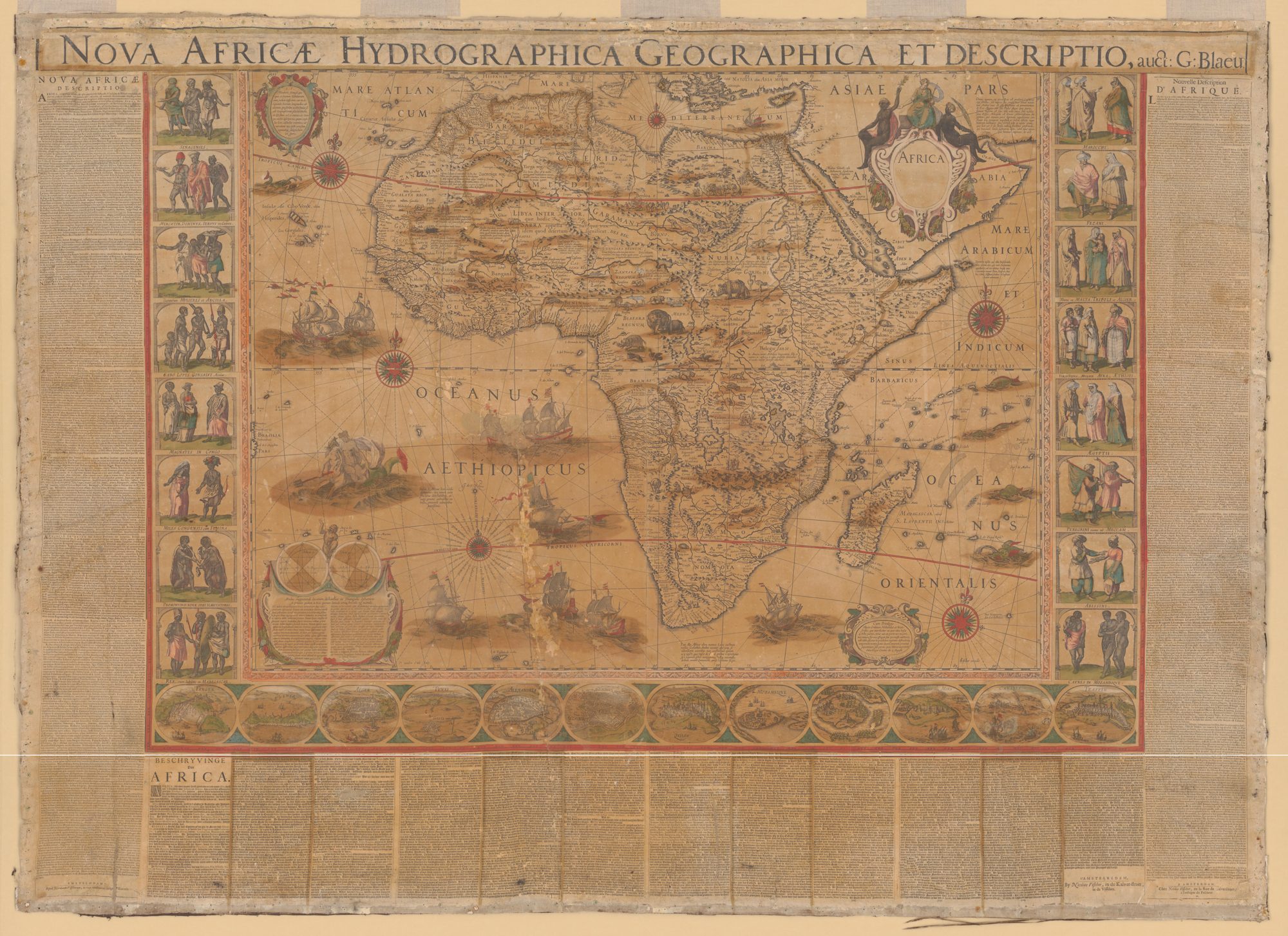
Cartographers: Willem Janszoon Blaeu; issued by Nicolaes Visscher (per LOC)
Date: 1657, Amsterdam
Held at: Library of Congress — loc.gov/item/2017585765
Image: Web copy on this page, 2,000 px wide; the LOC scan is 21,336 × 15,513 px — the full scan is served by LOC’s IIIF service, linked from the item record
Rights: Public domain (1657); LOC records no restriction
How to read these maps: the Atlas Source maps are European commercial cartography of their centuries — primary evidence of the European gaze as much as of African geography, with period place-names and colonial framings intact. None is African-produced; pre-colonial African cartography survives in other forms and other repositories, and that absence is part of the record.
Trust & evidence
Evidence before authority. CultureTechLens publishes its methods, its limits, and its corrections alongside its findings. Claims carry grades — VERIFIED, SUPPORTED, PROVISIONAL, DISPUTED, UNRESOLVED — and unknowns are never reported as zero.
Every claim graded. Every source named. Every correction public — see the corrections log.